New search areas for MH370 from world experts
01 February, 2020
4 min read
By joining our newsletter, you agree to our Privacy Policy


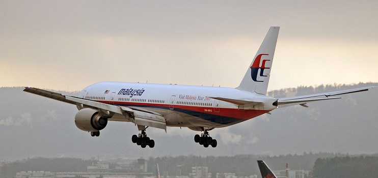
A group of the world's leading search experts for Malaysia Airlines Flt MH370 have defined new areas to be searched for the missing Boeing 777.
MH370 disappeared on March 8, 2014, with 239 passengers and crew aboard and while debris has been recovered the main body of wreckage has not despite two extensive searchers.
Malaysia has stated that it needs new evidence before starting a new search, although US-based search company Ocean Infinity has said that it will search on a "no find no fee basis."
After extensive revision and refinement of data search experts Victor Iannello, Bobby Ulich, Richard Godfrey, and Andrew Banks have defined a new area for MH370 adjacent to that previously covered and have released the findings in a detailed paper.
This paper, "Search Recommendation for MH370’s Debris Field", brings together all the independent work of these experts on MH370.
The paper states;
"The last search for MH370 was conducted by Ocean Infinity, who consulted with official and independent researchers and subsequently scanned the seabed along the 7th arc as far north as S25° latitude. Since then, independent researchers have continued to analyze the available data to understand what areas of the seabed are the most likely, and why previous search efforts have been unsuccessful."
"In a previous post, we presented an overview of Bobby Ulich’s research, aimed at more precisely locating the point of impact (POI) using statistical criteria that require that random variables (such as the reading errors of the satellite data) are not correlated, i.e., are truly random. A subsequent post describes the work of Richard Godfrey et al. to analytically evaluate a large number of candidate flight paths using these and other criteria. The results of that work suggest that the final hours of the flight were due south in the Indian Ocean along E93.7875° longitude, which matches a great circle between the waypoint BEDAX (about 100 NM west of Banda Aceh, Sumatra) and the South Pole. The POI was estimated to lie close to the 7th arc around S34.4° latitude."
This would be about 1800km due west of Dunsborough, Western Australia.
The map below shows the new areas to be searched for MH370 in green (A1), grey (A2) and then A3. The area previously search by the Australian Transport Safety Bureau is highlighted in yellow.
 The report states that "work continues to evaluate candidate paths using an accurate integrated model that includes satellite data, radar data, flight dynamics, automated navigation, meteorological conditions, fuel consumption, drift models, and aerial search results. That exhaustive work is nearing completion, and documentation of the methods and the results is ongoing. Like the previous work, the ongoing work suggests that the final trajectory of MH370 was most likely along a due south path along E93.7875° longitude."
READ the FULL report
READ: Coronavirus compared to SARS
The reports adds that "in the interest of providing information in a timely manner, we have chosen to recommend a search area based on this most likely path. A comprehensive paper which expands upon the methods and results presented in previous work, and provides further justification for the selected path, will be available in the near future."
"Using the results of the analysis presented above, the best estimate (BE) of the point of impact (POI) is based on a final trajectory of a constant longitude of E93.7875°, which is consistent with the aircraft travelling due south from waypoint BEDAX towards the South Pole. The BE of the POI is based on an impact exactly on the 7th arc, and the uncertainty associated with this BE is helped define the limits of the recommended search area."
The report concludes that "to define the search area near the BE POI, three cases were considered, each with an associated search area. The highest priority search area of 6,719 NM2 (23,050 km2) assumes there were no pilot inputs after fuel exhaustion. The search area of next highest priority encompasses 6,300 NM2 (22,000 km2), and assumes there was a glide towards the south after fuel exhaustion. The lowest priority is the controlled glide in an arbitrary direction with an area of around 48,400 NM2 (166,000 km2)."
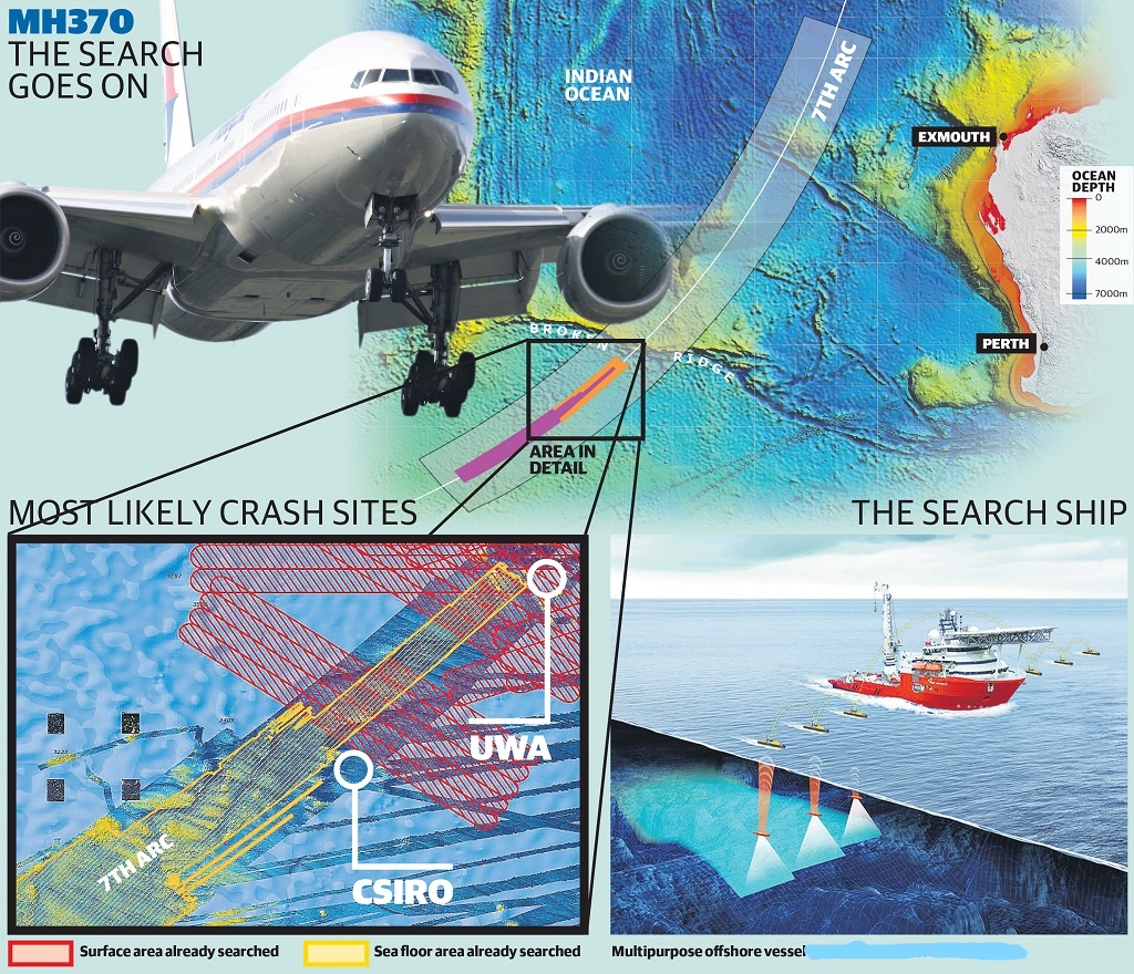
The graphic below on MH370, published in 2018, puts the new search area in context when compared to the graphic above. The new search area is between the areas defined by the Australian CSIRO and the University of WA.

Next Article
3 min read
Virgin gets nod for Tiger deal

Get the latest news and updates straight to your inbox
No spam, no hassle, no fuss, just airline news direct to you.
By joining our newsletter, you agree to our Privacy Policy
Find us on social media
Comments
No comments yet, be the first to write one.

